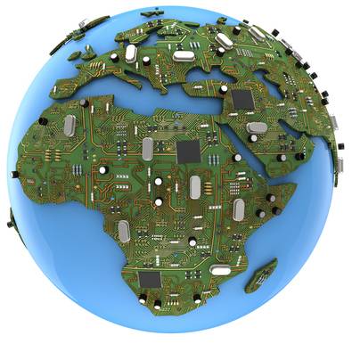
Geographical Information Systems (GIS) has become a key global-mapping tool to help discern spatial patterns and relationships. It is a software that allows layers of information to be piled onto a map, which allows for capturing, displaying, analysing, storing and checking data in accordance to the Earth’s surface. For example, you can display median household incomes, property values, ethnicities and median age groups for a regional location to compare it to that of another.
Studying these help better understand certain patterns that might occur. For instance, urban centres might have a median household income higher than those in the suburbs; from which we can easily understand that commercial and economic hubs are where people are paid more. For a country such as Pakistan with myriad issues such as land-grabbing, environmental injustice, poor urban-planning, slums and incalculable rural-urban migration among others, such a tool is an absolute asset to plan for and work out each individual predicament.
Lahore Development Authority (LDA) is supposedly making use of the software to prevent tampering of residential and commercial plots. A step in the right direction perhaps, but what ‘tampering’ actually entails is not clear. The fact that this project has gone overtime (one year) is not very heartening either. Red-tape and unwillingness by officials is the likely culprit for this, of course. At this time however, the LDA really needs to make a commitment to map out all projects through the use of GIS and use this to better structure their goals by taking into account spatial occurrences. As part of its pilot project, the LDA was able to map out Johar Town with its 23000 plots and 0.1 million files. These files need to be computerised, which may be cumbersome, but there is no excuse for our nation to still be so heavily dependent on paperwork that makes all processes taxing. Every legal property holder has documents, and for certain areas to be perfectly mapped out is not hard - those that cannot account for paperwork can be questioned.
GIS could benefit real estate, security, urban planning, environment and the poor in all aspects. For real estate, provided there is a secure system to prevent fraudulent measures, GIS helps mark out real estate properties with their values in different areas making it more accessible to the market, to realtors and the government. With proper paperwork and background checks, this could slowly make areas secure. This kind of mapping requires a lot of documentation especially about individual citizens (nationality, median household income, religion etc) within cities. If the civil society is accounted for, this could greatly benefit security of urban spaces.
For environmental injustice, this means mapping out where minority communities reside, what are the demographic and spatial patterns in those communities and how those can be improved, such as their proximity to land waste, which results in health issues, putting a greater strain on an already inaccessible health system. The environment could be hugely benefitted for instance, by mapping out urban cities and the strain they are posing on nearby ecological structures and resources. WWF Pakistan has already undertaken such a task, however they too are dependent on limited resources and government support. It is imperative these studies are undertaken because environmental degradation spells danger for human structures as well.
National Engineering Services Pakistan (NESPAK) too has seemingly indicated on its website that they intend to take on GIS mapping projects to provide satellite imagery, map digitalisation, terrain models etc. for better project planning, feasibility studies and reviews (for a date that has not been provided). Projects include; Conservation and Development of Land and Water Resources of Upper Kaha Hill Torrent Watershed for the Federal Flood Commission Government of Pakistan; and an Integrated Master Plan for Lahore for the LDA. Yet, no dates, timelines or even estimated budgets seem to be in place. Every project has a resolute ‘0’ allocated alongside it. Are we, the public to assume that these projects (like all others) will remain in the pipeline? For an organisation working on 3116 domestic projects, including the $1.65 billion dollar Lahore metro, it isn’t making effective use of mapping software.
A lot of primary research is required for GIS purposes no doubt, but it is not difficult to say the least. However, since the establishment of Pakistan as a nation state, a census was to be conducted every 10 years. The last time a census was held in our nation was in 1998, leaving the next census to be initiated in 2008. Not only did this not happen, the scheduled census for 2016 has been postponed yet again (17 years too late). For a country with an estimated population of 191.71 million in 2015 (making it the 6th most populous country in the world – UN research), and its numerous ethnicities, it is a society with ever-changing and dynamic social structures. A census needs to be carried as soon as possible and as fast as possible, however if left to our officials, there might be zero information at our disposal.
Moving into the 21st century requires a movement with technological and scientific advancement. Pakistan has an unprecedented population boom (1.6% annual change) that is having colossal effects, yet there is little to no primary research. NESPAK is the likely institution to undertake such a task in collaboration with other organisations such as WWF that have already undertaken some of the research. As a state-owned multinational, it is the only organisation with government support and required resources to undertake large scale projects.