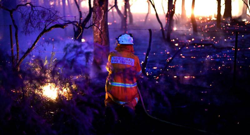
Record-high temperatures in Australia triggered bushfires across the country causing the death of dozens of people, hundreds of millions of animals and the destruction of over 1200 homes. Thousands of firefighters are fighting the fires, but the situation is getting worse as strong winds spread the flames.
NASA released new satellite images of the bushfires across Australian territories. NASA said that the images were taken by one of its observation instruments on 1 January.
“Catastrophic fires are ravaging large swaths of Australia, as seen in this image taken on Jan. 1 by one of our @NASAEarth observation instruments. Fire management officials can use satellite data like this to make life-saving decisions,” the agency tweeted, providing a link to its 'Worldview' website.
Catastrophic fires are ravaging large swaths of Australia, as seen in this image taken on Jan. 1 by one of our @NASAEarth observation instruments. Fire management officials can use satellite data like this to make life-saving decisions: https://t.co/22UjnM1LRS pic.twitter.com/gf4zeGvnLn
— NASA (@NASA) January 2, 2020
Since September 2019, Australia has been suffering raging bushfires, which have scorched at least 14 million acres of land. The fires are reportedly made much worse by an imbalance in temperatures in opposite sections of the Indian Ocean and a warming atmosphere over Antarctica, according to Australian weather scientists.
This is a 3D visualisation of the fires in #Australia. NOT A PHOTO. Think of this as prettier looking graph.
— Ekendra Lamsal (@Ekendra) January 6, 2020
This is made from data from NASA’s FIRMS (Satellite data regarding fires) between 05/12/19 – 05/01/20. These are all the areas which have been affected by bushfires. pic.twitter.com/rHagfHd9fr
Recently. Australian Prime Minister Scott Morrison announced the deployment of 3000 reservists from the Australian Defence Forces to help stop the fires.