LONDON-The next satellite tasked with maintaining the “gold standard” measurement of sea-level rise is about to enter final testing.
Sentinel-6a will pick up from the long-running Jason series of spacecraft when it launches in November 2020. These missions track the height and shape of Earth’s oceans with microwave altimeters.
Since 1992, the orbiting instruments have observed sea level go up by an average of 3.2mm per year.
This trend is accelerating, however. The most recent five-year period, from 2014 to 2019, has witnessed a 4.8mm/yr increase.
Sentinel-6a marks the first time this hugely important mission series will fly under the badge of the EU’s Copernicus Earth observation programme. It is still a joint venture between Europe (principally France) and the US, but the Copernicus patronage gives long-term security of financing.
In the past, there was always some uncertainty over where the funding would come from to initiate the next iteration of spacecraft. Now, not only is Sentinel-6a entering testing but its follow-on, Sentinel-6b, has all its money in place with construction due to begin in 2021.
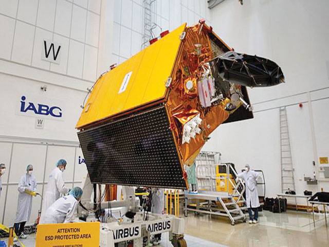
Senior space agency and industry officials gathered at the IAGB facility in Ottobrunn, near Munich, Germany, on Friday to celebrate one year to launch.
The IABG company will check over the Sentinel’s systems to ensure they are fit to ride to orbit on a Falcon-9 rocket.
When it eventually gets up there, Sentinel-6a will spend a number of weeks running alongside the current operational satellite, Jason-3. This will enable scientists to cross-calibrate their “Poseidon altimeters”.
These instruments are used to map the various “hills” and “valleys” in the ocean surface below. Understanding the variations in elevation over time has myriad applications, both short term and long term. Just as air pressure tells meteorologists what is going on in the atmosphere, so ocean height will betray details about the behaviour of water below just the top layers.
The data gives clues to temperature and salinity. When combined with gravity information, it will also indicate current direction and speed. The oceans store vast amounts of heat from the Sun, and how they move that energy around the globe and interact with the atmosphere are what drive key elements of our weather and climate systems.
CONNECT WITH US
Sentinel for sea-level rise enters testing
ePaper

ePaper - Nawaiwaqt

NIPCO House, 4 - Shaharah e Fatima Jinnah,
Lahore, Pakistan
Tel: +92 42 36367580 | Fax : +92 42 36367005
Nawaiwaqt Group | Copyright © 2024
