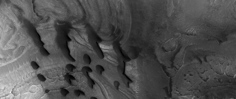
The images were taken at Nilosyrtis Mensae, a region of transition between the planet’s northern lowlands and southern highlands that is filled with what researchers have described as "fretted terrain".
Pictures taken of Mars show eerie sand formations on the red planet. The black and white photos captured by HiRISE camera on board the Mars Reconnaissance Orbiter (MRO), show a five-kilometre area of an impact crater in the Nilosyrtis region, with dunes dotted all over. Researchers say the dunes appeared after sand was blown with the wind into the region from the surrounding terrain.
The MRO has been studying the red planet since it reached Mars in 2006. The orbiter has been examining Martian geology and climate as well as the planet’s atmospheric circulation and seasonal variations. It has also sent data back to Earth on safety and feasibility of potential future landing sites for future space missions on the red planet.
In addition, the spacecraft has searched for signs of water, both past and present, to understand how it may have altered the planet's surface. For this purpose, the MRO examined the Nilosyrtis region, which scientists believe was once covered with ice. According to the European Space Agency, ice is thought to have flowed through the various valleys and across the plateaus in this region in the form of slow-moving glaciers that swept up debris as they travelled.
Researchers say the data on the Martian surface could reveal more details about the red planet and its evolution, as well as about our Solar System.


